Proposals
Delivering high-quality homes that meet local needs
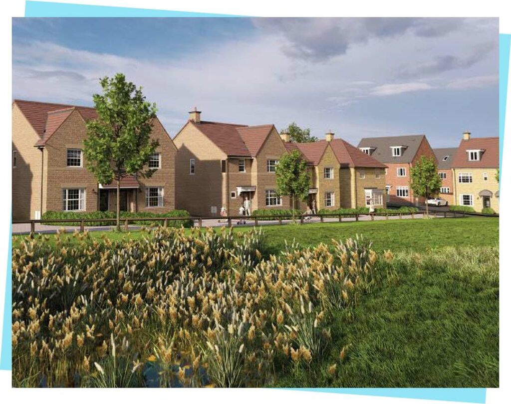
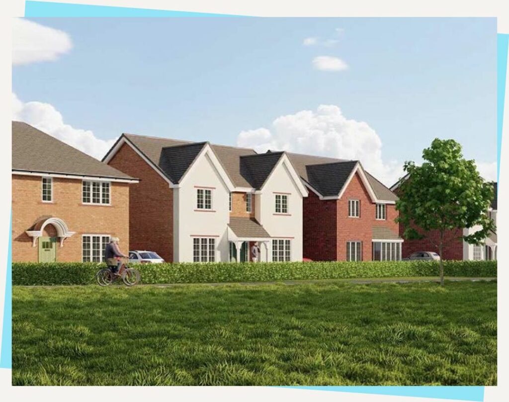
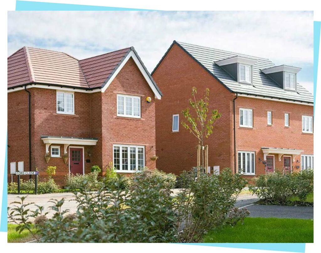
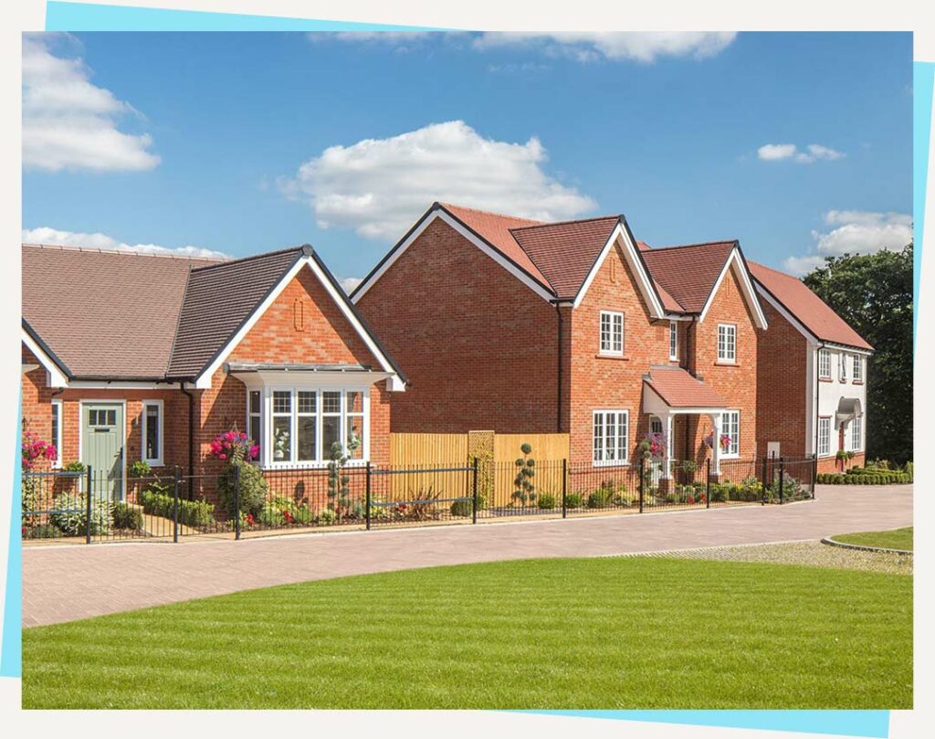
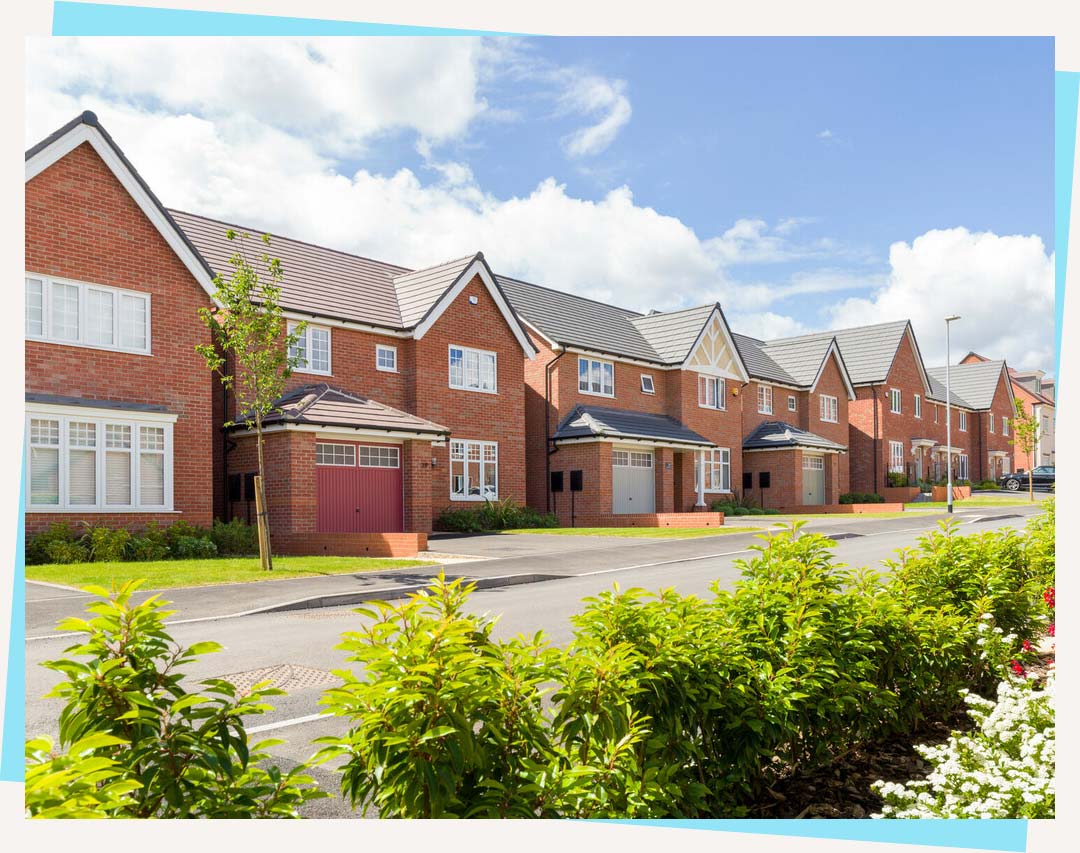
The proposals will deliver approximately up to 165 high-quality new homes, in a range of house types, including bungalows, and varying sizes and tenures addressing the differing needs of residents in Tiptree.
The new homes have been designed to not only complement the local area but also to allow the development to establish its own distinct sense of place, helping create a community.
As part of the proposals, 30% affordable housing will be provided in varying sizes and tenures which could include affordable rent, shared ownership, and First Homes, offering a range of options for residents looking to get onto the housing ladder.
The revised proposals present an opportunity to help deliver the housing need, while responding to key feedback from the earlier proposals to deliver a development that prioritises open space.
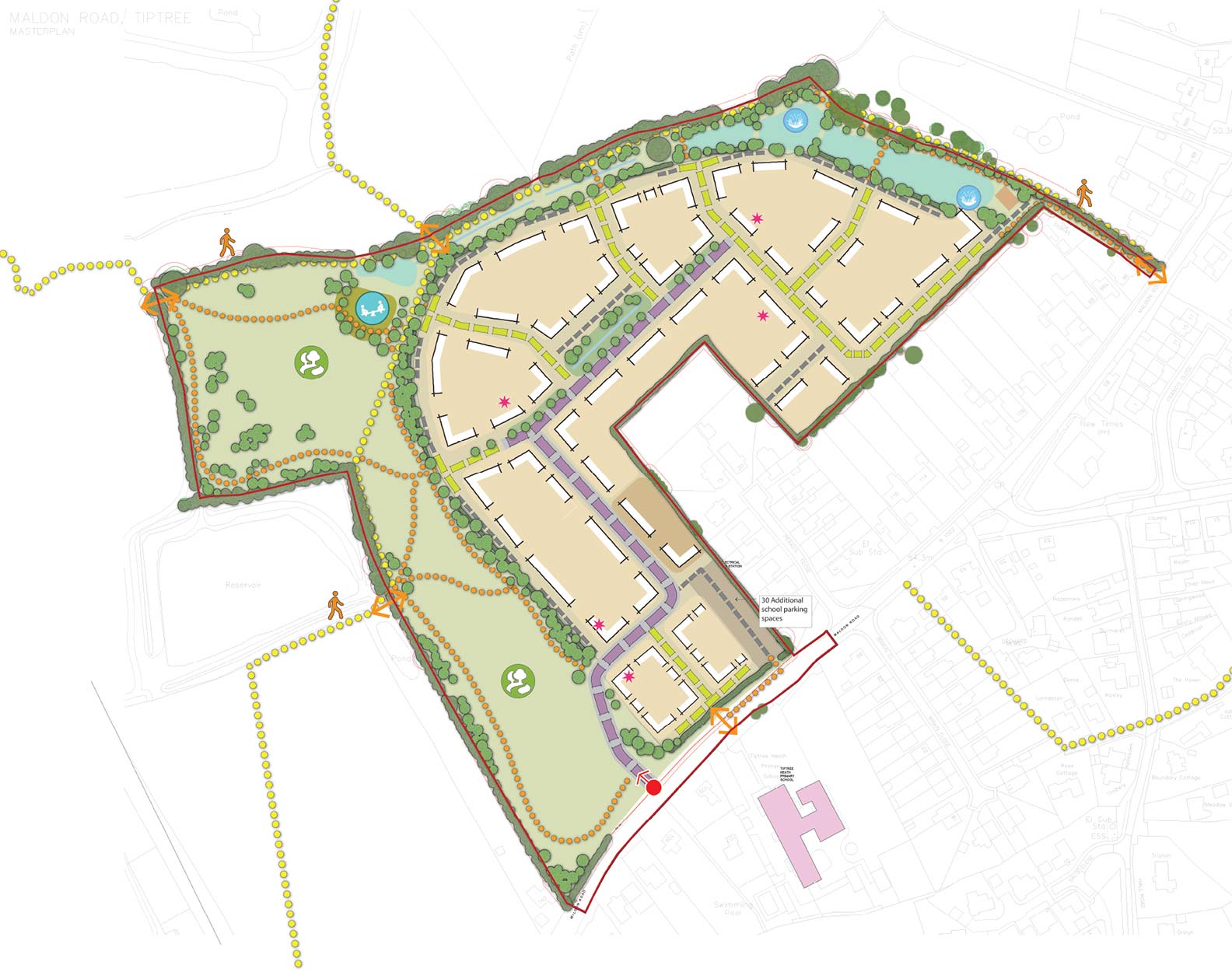
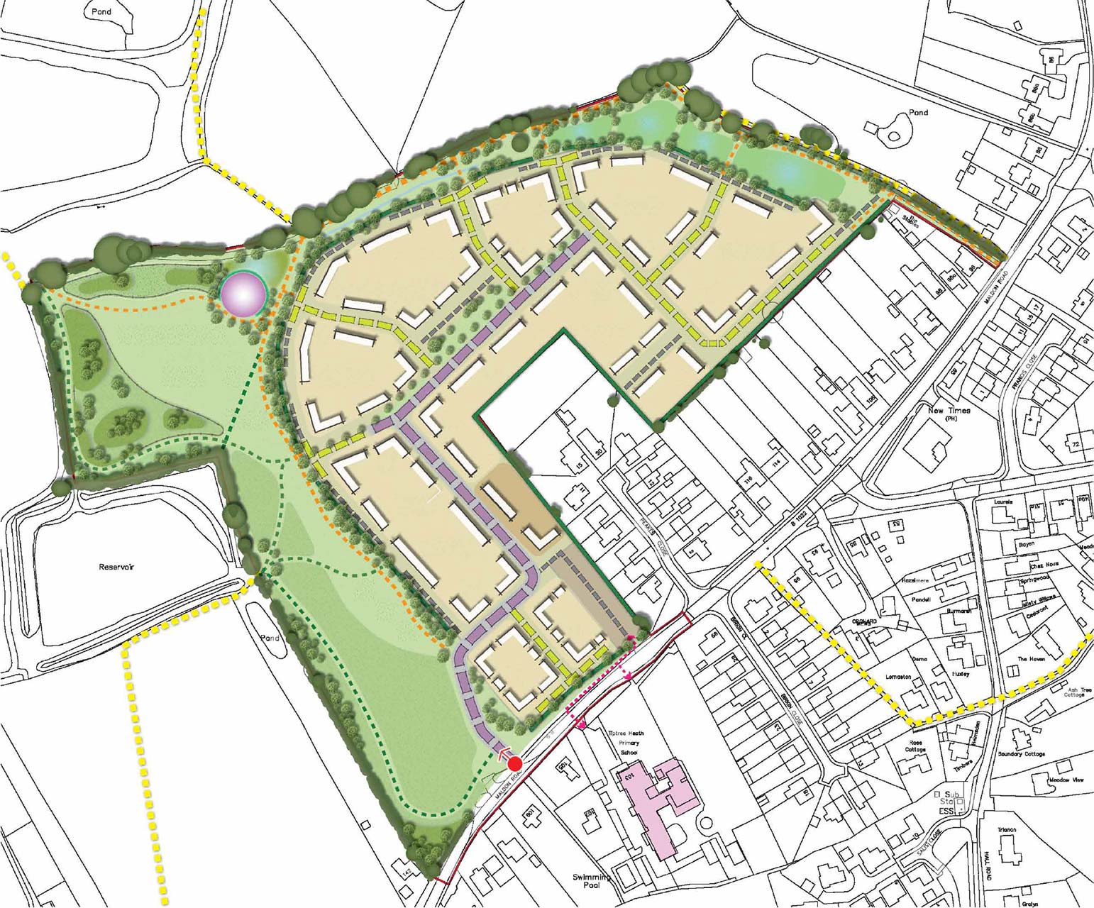
 Access point
 Pedestrian access points
 Site boundary 10.33 Ha (25.5 acres)
 Existing public rights of way
 Primary streets
 Secondary streets
 Tertiary streets
 Walking routes
 Residential development for up to 165 dwellings (5.39 Ha / 13.3 acres)
 Single storey residential development
 Additional school parking area (30 spaces)
 Existing primary school
 Attenuation basins
 Public open spaces
 LEAP
LEAP Swales
 Proposed trees
 Existing hedges
 Existing trees
Key features
- Mix of house types to respond to the needs of the local community including bungalows
- Additional landscaping along the western boundary reducing the coalescence between Tiptree and Tiptree Heath
- A community car park (approximately 30 spaces) to assist with parent parking demand at the primary school
- At least 10% local ecological enhancement
New homes
A range of sizes for individuals and families
The development proposals provide for a good mixture of 1-bed dwellings, 2 to 3 bedroom semi-detached and terraced houses and larger 3 to 4 bedroom detached homes, and the buildings will be predominantly 2 storeys with occasional 2.5 storeys and bungalows backing onto areas of Peakes Close.
Affordable housing will be seamlessly integrated into the development, adopting a tenure-blind approach to ensure no visible distinction between private and affordable homes.
The density equates to 32 homes per hectare, which is a reduction from the previous application.
As part of the proposals, four character areas will be used to create variation and local distinctiveness across the site. The character areas will assist in wayfinding and placemaking with each having a defined approach to architectural style and materials, as well as the surrounding landscape and infrastructure. The four character areas the site has been divided into are:
- Green Edge
- Western Edge
- Boulevard
- Peakes Edge
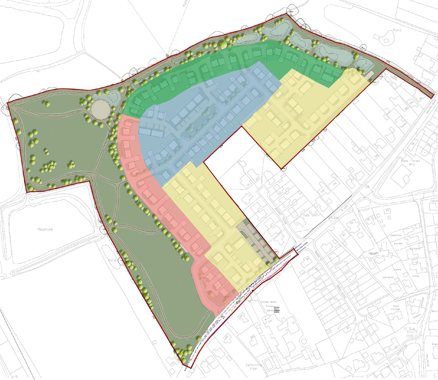
 Green Edge
 Western Edge
 Boulevard
 Peakes Edge
Green Edge
The Green Edge character area includes homes that front onto areas of green open space, creating an area that defines the transition between the residential area and the open space. Key features include:
- Street Types – Access via private drives and shared surfaces.
- Building Types – Predominately detached houses.
- Building Heights – Predominately 2 storey home.
- Density – Potential low/ medium density area due to the proximity from the sites boundary and SUDs.
- Building Setback and Parking – Looser building arrangement with a landscaped road edge to soften the built-up area. On-plot side parking is typical.
- Landscape/Boundary Treatments – Soft landscaping at the front, open views of the wider landscape, and pedestrian footpath connections linking to the circular footpath and nearby public rights of way (PROWs).
Western Edge
The Western Edge similar to the Green Edge borders green open space to the western edge of the site, serving as a transition between the residential area and the open space. Key features include:
- Street Types – Accessed via private drives and shared surfaces.
- Building Types – Predominately detached houses.
- Building Heights – Predominately 2 storey homes.
- Density – Potential low density of homes across the Western Edge to allow for smooth transition into the landscape.
- Building Setback and Parking – Looser building arrangement with a landscaped road edge to soften the built environment, and on-plot side parking is typical.
- Landscape/Boundary Treatments – Soft landscaping at the front, open views of the wider landscape, and pedestrian footpath connections linking to the circular footpath and nearby public rights of way (PROWs).
Boulevard
The Boulevard character area serves as the primary movement route within the development, centrally located with a focal open space. Its formal appearance is reinforced by consistent building lines, verges, and pavements. Key features include:
- Street Types – Access via the main spine road of the development.
- Building Types – Predominately semi-detached and detached houses.
- Building Heights – Predominately 2 storey homes.
- Density – Potential high density area due to being situated at the core of the development.
- Building Setback and Parking – Houses set back from the road to accommodate verges and tree lines. On-plot parking is mainly to the side, maintaining a consistent building line, except where interrupted by the central public open space.
- Landscape/Boundary Treatments – Soft landscaping, verges, and tree planting enhance the street hierarchy and reduce visual impact.
Peakes Edge
The Peakes Edge character area includes homes within the inner parts of the development and allow the inner edge of the site where consistent building lines and small gaps between buildings will occur, encouraging social interaction. Key features include:
- Street Types – Access via shared surface roads.
- Building Types – Predominately semi-detached and terraced housing.
- Building Heights – Predominately 1 & 2 storey homes.
- Density – Mixture of density ranging from low to high due to the proximity to Peakes Close, the site entrance and serving the primary street.
- Building Setback and Parking – Regular building intervals with formal setbacks from adjacent properties. On-plot parking is mainly at the front, leading to narrower gaps between houses.
- Landscape/Boundary Treatments – Soft landscaping, hedgerows, and tree planting to reduce visual impact of parking. An enhanced landscape buffer is planned along the Maldon Road frontage.
Landscape-led scheme
Outdoor spaces that can be enjoyed by all
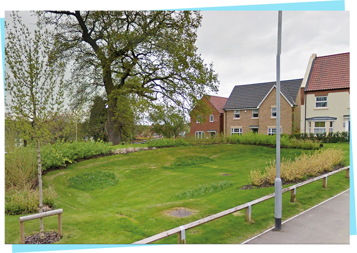
As part of the proposals, the new development will deliver significant areas of public open space that will be accessible to all, designed to foster community activities and recreational opportunities.
These spaces are planned to include children’s play areas, communal gardens, and pathways that encourage outdoor activities and enhance social well-being.
Views across the site will be retained, with a substantial area of land designated to be left in its current agricultural character to maintain a gap between Tiptree and Tiptree Heath.
The following principles have been adopted to help steer the design process of the green open space:
- Strengthen northern, north-eastern, and western boundaries with native tree planting to enhance ecological value.
- Reinforce southern boundaries with native hedgerows to minimize visual impact.
- Introduce native trees, shrubs, acid grassland, and wildflower meadows to support wildlife.
- Integrate SuDS basins within a landscaped buffer on the northern and north-eastern edges.
- Maintain the western edge as open grassland, preserving a visual corridor between Tiptree and Tiptree Heath, with amenities such as a play area, wildlife pond, and walking routes connected to the existing public rights of way (PRoW) network.
 Site boundary
 Access point
 Existing hedges
 Existing trees
 Primary streets
 Secondary streets
 Tertiary streets
 Pedestrian connection to school
 Single storey residential development
 Additional school parking area (30 spaces)
 Proposed substation
 Proposed trees
 Proposed native hedgerow planting
 Attenuation basins
 Wildlife pond
 Amenity grassland
 Acid grassland
 Native shrub planting
 LEAP with swale feature to feed wildlife pond
 Proposed swales
 Proposed post and rail fence
 Existing PRoW outside of site boundary
 Mown grass paths (existing PRoW)
 Self-binding gravel paths (existing PRoW)
 Proposed grass paths
 Proposed self-binding gravel paths
Sustainable materials
Commitment to sustainability
Sustainability is at the heart of our development strategy. The site has been designed to meet high environmental standards to support a sustainable future. Key features include:
- Energy Efficient Homes: All new homes will be built to high energy efficiency standards, helping to reduce carbon footprints and energy costs. Additionally, high-quality, durable materials with low environmental impact and manageable long-term costs will be used.
- Building Regulations: The development will comply with the latest standards for insulation and resource-efficient materials, with details on the construction methods proposed provided at the detailed design stage.
- Water Management: Sustainable urban drainage systems (SUDS) will be implemented to manage surface water effectively and reduce flood risk.
- Waste Management: Centralised, accessible waste collection points with clear signage and facilities for separating recyclables, organic waste, and general waste, promoting responsible disposal.
Health and wellbeing
Fostering active living in Tiptree
Our development is designed with health and well-being at its core, providing numerous opportunities for residents to lead active and healthy lives.
Dedicated paths will promote cycling and walking as primary modes of transport, reducing car dependency and enhancing air quality. This will enhance connectivity between Tiptree, Tiptree Heath and the surrounding areas.
Key features to help ensure connectivity with surrounding areas include:
- Main Access: Pedestrians and cyclists will be able to use the main access point using the proposed 3.5m shared pathway or the 2m footway.
- Additional Links: A further pedestrian link near the proposed school car park connecting to Maldon Road is proposed.
- North-Eastern Access: A new pedestrian/cyclist access point is proposed in the north-eastern corner via an existing track serving ‘The Stables,’ with the current access for ‘The Stables’ retained.
- Upgraded Route: A 3.7m shared footway/cycleway extending into the development is proposed, with optional removable bollards for emergency access.
- Public Rights of Way (PRoW): Existing PRoW footpaths (routes 19, 20, and 21) along the northern and western boundaries will be preserved, providing separate pedestrian access and internal PRoW routes will be integrated and enhanced within the final development plan.

Site access
Well-designed access and safer crossing points
Our proposed vehicular access point for the new development will be through the creation of a new access off Maldon Road to the south of the development.
The proposed access arrangement will have a 5.5m wide carriageway and 6m kerb radii with a 2m wide footway on the western side and a 3.5m shared footway / cycleway on the eastern side, which is over and above the minimum standards.
Part of this new vehicular access will include a proposed crossing across Maldon Road connecting the site car park with the primary school opposite the site, allowing for safe crossing to access the school.
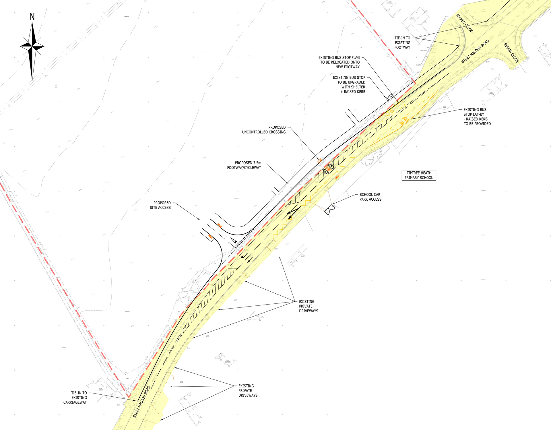
 Site boundary
 Existing road markings
 Proposed road markings
 Proposed footway
 Tactile paving
 Indicative existing highway boundary transcribed from ECC records
 Existing private drive (crossover / dropped kerb)
Flood mitigation
Sustainably designed surface water management to help prevent flooding
The surface water runoff from the proposed development will be managed by a Sustainable Drainage System. The Sustainable Urban Drainage System (SUDS) will either rely on infiltration of water to the ground or controlled discharge to the watercourse network, in this case via existing field ditches. The Illustrative Masterplan shows attenuation basins around the site to manage surface water runoff and discharge.
The system is capable of managing storms up to 1 in 100-year event, inclusive of a 40% climate change allowance. The forthcoming planning application will be supported by a Flood Risk Assessment and surface water drainage strategy.
Local infrastructure
Planning obligations and contributions
As required by Colchester City Council and other statutory consultees (such as the NHS) our proposals will be supported by any necessary planning obligations and contributions towards local infrastructure such as additional school places, local healthcare improvements and local transport improvements.
The need for these improvements will be determined through the planning process, but we welcome your feedback on what you believe is necessary.

Community Car Park
Addressing local parking needs
A key feature of our development is the introduction of a community car park with approximately 30 spaces, designed to address parking demands at Tiptree Heath Primary School. This facility will ease local parking issues by providing additional spaces and a safe drop-off area for parents and guardians.
The new car park will significantly benefit the school, improving access and helping to streamline operations. By reducing congestion during peak drop-off and pick-up times, we aim to create a safer environment for students and families while promoting greater use of local amenities within the community.

Timeline
Overview of the proposals process
Timeline is subject to change due to planning and consultation.
Autumn 2024
Final masterplan and outline planning application information event
Spring 2025
Planning application submitted to Colchester City Council
Autumn 2025
Currently anticipated planning committee determination of planning application